Vilnius, 2023, 518 p., Lithuanian ISBN 978-609-478-078-3
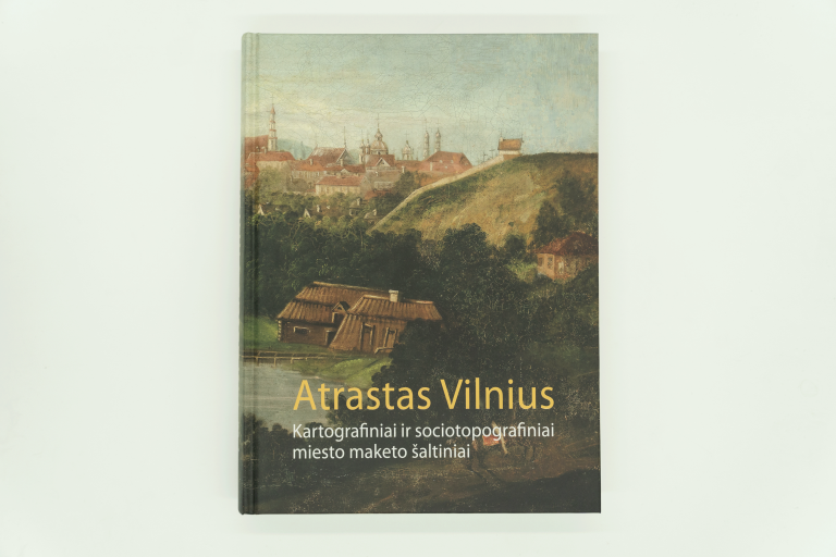


Vilnius Discovered. Cartographic and Sociotopographic Sources for the City Layout
€40,00
Turime
Turime
ISBN 978-609-478-078-3Description
The book "Vilnius Discovered. Cartographic and Sociotopographical Sources for the City Layout" is the result of five years of intriguing research. It is based on cartographic material from the Russian military archives covering the Old Town and Vilnius' suburbs as well as a map of the entire city for the years 1832-1834, layouts of 38 street facades and the schematics of 13 city blocks. These are colourful, architecturally accurate images used to create a model of the city. This cartographic collection, which has attracted the interest of Lithuanian historians since the 1960s and has been instrumental in the urban study of Vilnius, will finally be made available to the public in the form of this book. No other Lithuanian city has such a unique iconography.
The archival sources and iconography used here provide a better understanding of the history of the city's built environment and reconstruct its topography. The collection of cartographic documents is complemented by images, photographs and portraits of the city - 360 illustrations in total. A social portrait of the town's inhabitants has been reconstructed on the basis of homeowner censuses from the years 1775-1845. We hope that this book will not only help to reconstruct a city, most of which has been lost to time, but also to engage in a conversation with the inhabitants of past centuries.
Tikimės, kad ši knyga ne tik padės atkurti miestą, kurio didžioji dalis nebeišliko, bet ir leis užmegzti pokalbį su praėjusių amžių miesto gyventojais.
Publication authors: Karolina Glinska and Birutė Rūta Vitkauskienė. Artist: Vida Ona Kuraitė.
Additional information
| Weight | 2,3 kg |
|---|---|
| Dimensions | 31 × 23 × 4 cm |